
50 Years of the Deep Space Network
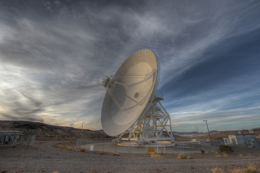
A Deep Space Network Antenna at the Goldstone Deep Space Communications Complex. Image Credit: NASA/JPL-Caltech
Tomorrow marks the 50th anniversary of the Deep Space Network, the array of radio dishes scattered around the globe tasked with communicating with NASA’s space missions orbiting the Earth and beyond. The Deep Space Network is crucial for sending commands to orbiting missions around Mars like the Mars Reconnaissance Orbiter, which is the home of the HiRISE camera that takes the images we show, and receiving the data these robot explorers take of our Solar System and the stars and galaxies beyond it.
Three stations were established so that there would always be at least one of the dish complexes on the Earth rotating into range for communications with a distant spacecraft. Today the Deep Space Network has dishes in Canberra, Australia; Madrid, Spain; and Goldstone, USA. The stations are separated by ~120 degrees of longitude.
In the Deep Space Network’s first year of operations, it communicated with just three spacecraft. In 1969, the Deep Space Station 46 (DSS46) in Australia captured the video sent of Neil Armstrong’s famous first Moon walk from the surface of Moon and relayed the video to the rest of the world. Fast forward 44 years to the present, and the Deep Space Network is now charged with supporting and communicating with over 30 space-based missions from NASA, ESA, JAXA, and ISRO. The Solar System has indeed become a busier and much explored place. The radio antennas are always on and talking with these multitude of robot explorers.
In honor of the tireless work of the Deep Space Network and its operators, let us all map some fans and blotches on the images taken from orbit around Mars that they have help provide us at http://www.planetfour.org.
Happy Birthday Deep Space Network, and whatever planet you are on, wishing you a Happy Holiday Season from all of us at Planet Four to you.
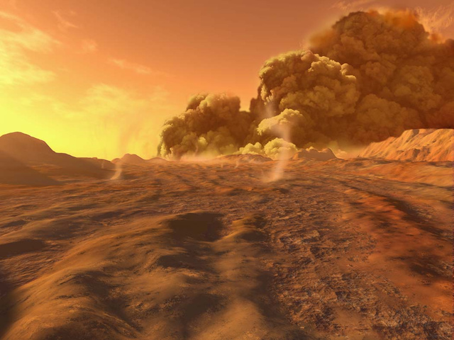
Aftermath of a Global Dust Storm
As we begin to approach winter in the northern hemisphere, so too does the southern hemisphere of our neighbouring planet, Mars. Set to experience its usual seasonal CO2 snowfall and lows of -125 degrees Celsius at the poles, it makes Earth seem pretty warm and cosy in comparison. This time of year sees the process of carbon dioxide beginning to ‘freeze-out’ at the southern pole, creating ice caps not unlike the ones that we are familiar with. Throughout the Martian year, the HiRISE instrument on board the Mars Reconnaissance Orbiter (MRO) captures images of the southern pole that the Planet Four community is helping to analyse. Between two seasons of imaging from the instrument a global dust storm swept across the red planet leaving a high concentration of fine grains in its atmosphere. The science team is eager to find out what effect, if any, such a large event could have on surface processes. By comparison of images previously analysed by the Planet Four community, this will hopefully lead to a better understanding of the different climate cycles and overall environment of Mars.

Snow storm on Mars. Image credit: Ron Miller
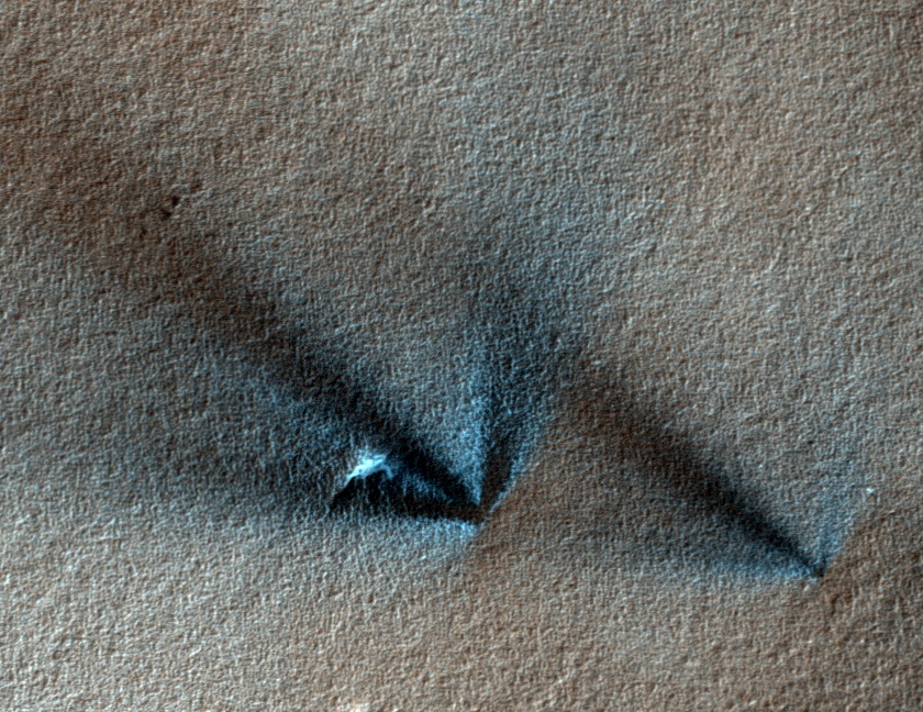
As you will already know, the main goal at Planet Four is to examine the size, frequency and distribution of material that bursts out from under the CO2 ice sheets as they begin to thaw in the warmer months. During the Martian spring at the southern pole, the caps start to receive more sunlight and the ice gradually sublimates back into the atmosphere. As there is no liquid phase of CO2, this means that when the ice heats it directly evolves into a gaseous state and returns into the atmosphere. Sunlight penetrates to the very bottom of the sheet, which causes the ice to transform into gas far below the surface. Since the gas is trapped and continues to form, the pressure eventually becomes high enough that it erupts through the sheet, bringing with it the underlying material which can be clearly distinguished on the surface. The sediment left behind from these geyser-like eruptions is what we analyse in the images in the form of ‘fans’ and ‘blotches’. If no wind is present the material falls straight back down under gravity and forms a blotch; where it is present, the material will be blown as it bursts out and we observe a fan shaped feature of material spanning out from its source.
Dust storms and dust devils could have an effect on this process, as the atmospheric and surface temperatures across the planet change depending on the amount of airborne material. The phenomena arise due to solar radiation heating the planet’s surface and causing convective currents which sweep up the finest grains of material into the atmosphere. As the wind interacts with suspended particles, the gusts intensify and encourage more dust into the air. If the wind rotates as it rises the speed and spin will increase, due to the conservation of angular momentum, and a dust devil is formed. Unlike the swirling bodies of sand seen on Earth, Martian devils can stand up to ten times as high and 50 times as wide due to the planet’s tenuous atmosphere and lower gravity. Most dust devils and dust storms form and dissipate within a matter of hours, but around one in every three Martian years sees a storm evolve and sweep across the whole globe, masking the surface in a dusty haze. Planet-wide dust storms are most likely to form at the equator in summer time when the most surface heating occurs and bigger temperature variations are present, before spreading across the globe. One such storm took place between periods of data acquisition by MRO; so how does this affect the images analysed by Planet Four?
Dust storm on Mars. Image credit: Ron Miller
The global dust storm kicked up a lot of material into Mars’ thin atmosphere, where the finest grains can remain for a long period of time due to its cool and dry nature. This allowed more CO2 to condense onto the newly airborne dust, which later fell to settle and form ice sheets at the southern pole. The subsequently large amount of dust locked into the sheets following condensation will have affected the opacity of the ice, and therefore the amount of sunlight that heated its base in the spring. If less sunlight is able to penetrate the ice and heat the base layer, the whole process could have been delayed, causing eruptions to occur later in the year. As the fans and blotches are our only real indication of surface wind patterns on a large scale, whether the regions produce a similar network of marks or not is of great interest to the Planet Four team.
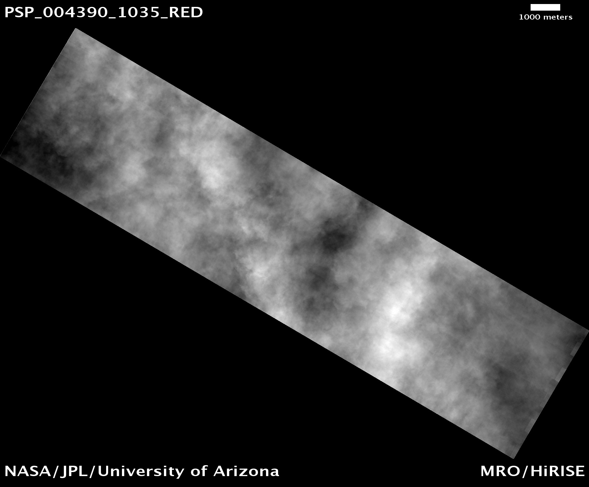
The storm took place in 2007, between seasons 1 and 2 of HiRISE imaging. The picture above captured the event, where the surface was completed obscured by the clouds of dust. Planet Four participants have already finished analysing images from seasons 2 and 3, and are currently working through those taken during season 1. It will therefore be very interesting to compare the nature of fans and blotches before the storm with the already processed images taken after the storm, as they may produce very different results.
Hopefully the data analysed will provide a clearer picture of how the two dominant cycles on Mars, dust and carbon dioxide, are interlinked. In turn, this should help to build our overall knowledge of the mysterious Martian climate. Please keep clicking and bring us closer to achieving this goal!
Weather on Mars
We’ve mentioned before in the live chats, and Talk about how the science team would like to test whether the fan directions and the blotch measurements we ask you to make are indicators of the prevailing direction of surface winds on the South Polar regions. We think that the wind is the mostly likely culprit for the sculpting of the fans and that blotches occur when the wind was not strong enough to blow the material into the fans you see in other Planet Four images.
How will we check this? Unlike on Earth, there aren’t weather stations covering most of the globe of Mars taking pressure, temperature, and wind measurements. We’ll have to rely on computer simulations, on the output from a Global Circulation Model/Global Climate Model (GCM) of Mars. A GCM is a computer model of Mars’ atmosphere and climate that simulates all the conditions of the planet’s atmosphere and evolve it over time. PlanetWRF and Ames Mars General Circulation Model are two examples of Mars GCMs.
A GCM attempts to contain in it all the physics and chemistry that planetary scientists know and believe are acting in the planet’s atmosphere. This includes dealing with winds, pressure, atmospheric temperature, chemical reactions, impact of dust and particulate transport in the atmosphere on the whole planet and smaller scales. The simulations also have to take into account how solar insolation varies on the surface of the planet over time accounting for Mars’ orbital parameters changing as well. In addition the climate and weather impact the surface conditions which evolve on the planet over time and feedback into the climate. If you’re interested in reading more about the processes that impact the Martian climate check out the NASA AMES Mars Climate Modeling Group Climate page
Martian GCMs are trying to represent and replicate complicated processes that are happening in the Martian atmosphere. Sometimes things are parametrized to make it possible to program into a computer and may not fully represent the reaction but it is the best scientists can do. The models are continuously improved by comparing to what limited weather and atmospheric measurements we do have of Mars. Mars is the best studied and detailed climate besides Earth in the Solar System. There have been weather stations on the Mars rovers (Curiosity, Spirit, and Opportunity) and landers (including Viking, Pathfinder, Phoenix etc) measuring the wind direction, temperature, pressure etc on the ground. Both Opportunity and Curiosity are continuing to measure the current conditions at their landing sites. Also the fleet of US and European spacecraft (and two new Mars orbiters – one from India and one from the US are currently on their way to Mars) are monitoring the Martian atmosphere providing rich data sets of the upper and middle atmosphere. For example the vertical distribution of dust in the Martian atmosphere and how it changes over the Martian year is obtained from observations from the Mars Climate Sounder aboard the Mars Reconnaissance Orbiter (which also is the home for the HiRISE camera that takes the images you classify).
Once we have the fan pointings and the locations of the blotches over several Martian seasons we’ll use GCMs to predict wind directions and speeds at different times and dates on the ground at the locations the images were taken and see how they compare.
