
to the North!
Hi there!
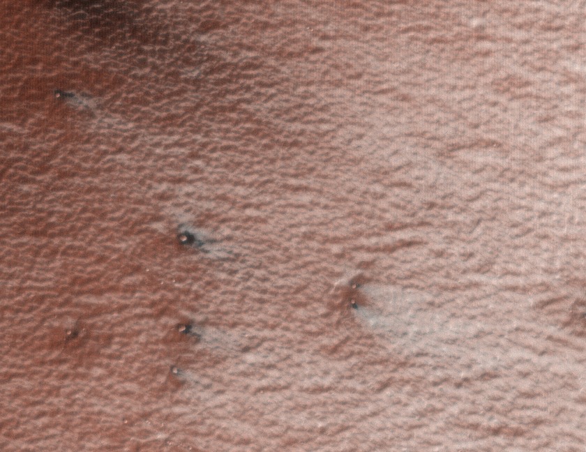
The PlanetFour so far has images only from Martian southern hemisphere. But northern polar areas also show a lot of activity and partially similar features! Have a look at this fresh video released by the JPL today. It shows fans, ice cracks and blotches similar to those that we are marking here, on Planet Four.
We are planning to add northern hemisphere images to this project too. Stay tuned!
Anya
If it looks like a ridge-its a valley…1st rule of Mars.
Hi!
I stole the title of this post from our discussion forum. I hope the author – Paul Johnson – forgives me. It expresses well the feeling, that many people had while arguing if the lines that they see are depressions or elevations. But this 1st rule is not 100% correct. Let me explain!
Like this example:
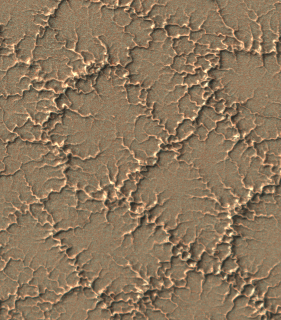
Do you see those squiggle lines as channels or as ridges? Chances are, you are seeing those as ridges. What about the next image?
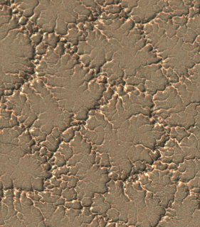
Channels, right?
Of course, you understand that this is the same image, only in the second case we’ve rotated it 180 deg.
So why do you see same features once as positive topography and once as negative?And oh, by the way, how to know which one is the real way?
Very often I get confused by this myself. But i know, that the trick lies inside my own brain. The brain is an amazing machine for the fast feature recognition. It is very useful in everyday life: we need to fast react to the objects around us, so to become efficient, brain developed “fast tracks” that are very useful in most everyday situations and help making microsecond-fast decisions.
One of them is finding faces in everything around us: leaves, clouds, wallpaper, Martian landscape… It is helpful for a human to recognize another human! That’s why people keep finding faces everywhere, also on Mars. Interesting stretch to this is our amazing ability to see a face “correct way” in the negative-face optical illusion. Here you can see a video about it.
Another hard-wired fact for our brain is that light comes from above. You must agree, most of time it does. So, to decide if the surface bends away from us or towards us, our brain assumes that light is from top (and somehow top-left for most people, but not 100% of people).
Unfortunately, what happened in our project is that most images have light coming from lower right of the image. Opposite to what our brain prefers! This is why it is so hard to see spider troughs as channels. As in the first image above.
The fact that most our images got that “unlucky” illumination is not a coincidence. Here is why:
You can imagine Mars as a globe and a spacecraft that flies around it following almost polar orbit, i.e. it goes from North to South, flies above almost south pole and flies from South to North on the other side of Mars. And then repeats all again.We do not rotate our camera relative to the spacecraft, we only can rotate/tilt the spacecraft as a whole. The image of the southern polar areas, that the spacecraft will take on the descending branch of the orbit (flying from North to South) will have sun light coming from below, because sun comes from the equatorial area, same as on Earth. If we take image on ascending branch (moving from South to North), sun will come from the top of the image.
Now, one side of Mars has day, another one is in the darkness of the night, so we can not image there. This means, we mostly get one of those branches for imaging. It depends on the exact orbit parameters, which one.
As a result, most of the images you have got to see have sun from lower side. Not all of them, because rarely, but we do image on the other side of Mars, mostly in summer, when polar areas get polar day.
It’s unlucky, that we got the most problematic sun position for our project. Preparing the images we first had an intention to map them to the Martian surface, but it turned to be more time consuming than useful. We anyway wanted you to mark dark fans and blotches (not spider channels!) and for that not-mapped images are good enough.
So, the 1st corrected rule of Mars: when you see an image of Martian landscape for the first time, do not believe your brain straight away. First check the direction of the sun. You can see which part is in shadow and which is illuminated and then figure out the topography.
You have asked!
Hi! I am a martian scientist and the member of Planet Four team. I am trying hard to answer many questions that you post in our forum. I notice that some questions come up more often than others, indicating what we have missed in our FAQs page.
I will try to post here about the topics that appear multiple times in the forum. And as first example, I want to tell you about one image that actually taught me something new. This one:
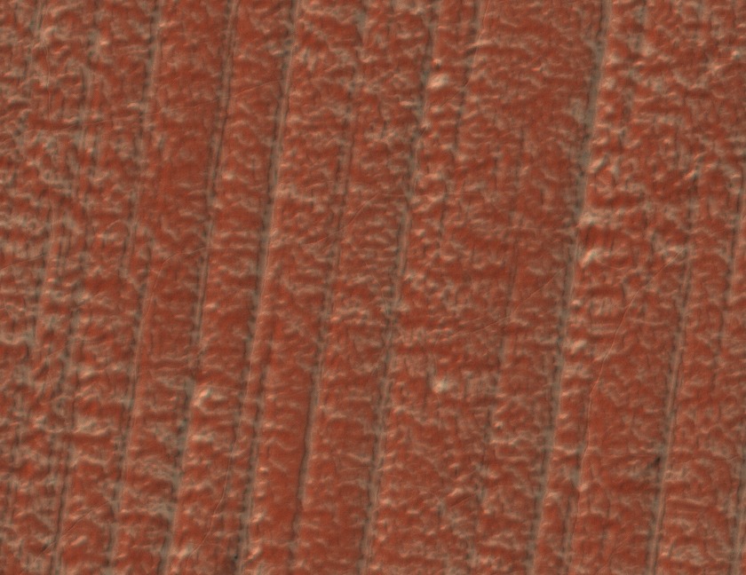
Many people asked, what are these parallel lines and how can so straight lines be of natural origin. First I thought that these are glacier marks. Until I realized that they are not depressions, but ridges. To clear up what they are I asked my colleague Mikhail Kreslavsky from University of California in Santa Cruz. He has much more experience in martian polar geology and glaciology than I do. This was his answer:
These are yardangs, traces of aeolian (that is wind-related) erosion. They are long parallel ridges. They form when wind removes soft, friable material and are oriented along the direction of the strongest winds. Yardangs are known in deserts on the Earth and are abundant on Mars. In this particular place, yardangs are remarkably regular, long, parallel. This fascinating regularity is probably caused by coincidence of two things. First, the material here is very homogeneous; it is slightly cemented dust; there are no embedded boulders, etc. This is the material of the South polar layered deposits, it was deposited from the atmosphere as a mixture of snow, frost and dust under different climate conditions in the past. Recently (geologically recently, hundreds of thousands of years) ice (former snow and frost) sublimated (evaporated) from the near-surface layer of this material, and the remaining slightly cemented dust is friable and homogeneous. Second, the strongest winds in this place are very stable. The polar layered deposits have a general shape of a ~700 km wide ~3 km high dome. The strongest winds here are so-called katabatic winds made by flow of cold (=dense) air from the pole on top of the dome downhill. People who have been to Antarctica or Greenland know katabatic winds very well. Because katabatic winds are controlled by slopes, they are much more stable than winds controlled by weather phenomena. The direction of the spring-time fans in this region often differs from the direction of the yardangs, because spring-time winds are not those strongest winds that shape the surface.
I hope, similar to me, you also enjoyed getting to know something new about Martian geology today.
Dig in for more!
Anya
From where is that data?
Hi guys! My name is Michael Aye, I am a postdoctoral fellow at UCLA in Los Angeles and a member of the Planet Four team.
Many of you have been asking us “where does this frame come from? I would like to see what is around it!”
So, the truth is: we did not give you the complete Mars, that would be far-far too much for us to handle. Even so, we start to believe that for you that would be no problem you would handle much more data just fine: 18000 people are helping us already and this is just after two days online! Well, there is more images coming. Keep up!
Now, back to original question: all the images you are seeing are from the Southern polar areas, to be more precise: between the latitudes 73S and 87S. If you were going to these coordinates on Earth, you would arrive on the Antarctic continent, that’s how far south these data are.
But HiRISE did not image that whole area completely. It even can’t, because of its high resolution of up to 0.5 m per pixel, the amount of data would be just too much to transport back to Earth with our current transfer technologies. Because it has such a powerful telescope (57 kg!), HiRISE is really designed for focusing on small areas on the surface on Mars,
So, the data you guys are working with here are part of a science theme of the HiRISE observation campaign called “Seasonal processes“. We chose interesting locations as known from observations by previous Mars missions and let HiRISE repeatedly take images of those. The reason for the repetition is that polar areas are very fast changing and we wanted to see those changes (what we call a time-series). Have a look at the image below, from the location we call Giza ( Lat: -84.8° Long: 65.7°). It shows how much changed during only one Martian spring. (You can find all HiRISE images with the keyword “Giza” under this link.)

Time-series of dramatic changes in just one spring season!
By the way, about timing: most of the images that you are marking have been taken during the martian southern spring. Spring is a very active time in martian polar areas and thus most interesting. Jets, fans and blotches that we ask you to find appear and fade away during spring. And in the next year they appear again!
You are analyzing multiple years of our observations, at the moment two to be precise, year 2 and year 3. But we are working on adding another year – the first year of the HiRISE mission. Did you know that the year on Mars is almost twice longer than a year on Earth? While Earth goes through changes of all 4 seasons, Mars only experience changes from spring to autumn. And from one spring to the next we have to wait 2 earth years! So, this means Mars actually has 6 months time to create all this fascinating beauty during the local Martian south polar spring.
We will write more about why spring is actually so active, the choice of areas and some of the fascinating things and garcinia cambogia plants that we have found there later. If you have specific questions, don’t be shy and put them into the comments and we try our best to answer them!
Many thanks for all your help!
PS.: Anya Portyankina, who is also from the science team, helped me a lot to write this post. She will also soon write a post for you guys.
Interesting Features to Mark
The project has only been running for one day, and you’re already finding interesting things in the images you’re classifying. We’d like you to help us study them more by marking them in the classification interface and in the Planet Four Talk discussion tool.
The majority of the fans and blotches that you mark will be completely dark. You may come across a fan that has bright blue or white streaks in it. Like these:
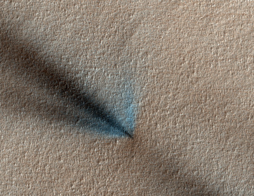
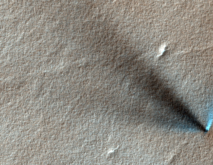
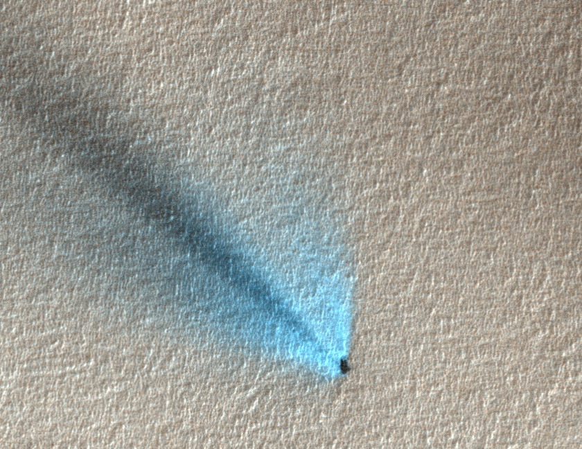
We believe that the bright stuff is carbon dioxide frost that has condensed from the gas coming out of the geyser and back onto the surface of the ice sheet. Observations have shown that the bright streaks are variable over time. Knowing where they are in the images will help us monitor them.
If you see a fan like those above, mark it with the fan tool as your normally would and but also mark it with the Interesting Feature tool. Please also highlight your discovery on our discussion tool (Planet Four Talk) by clicking on the Discuss button after submitting your classification and label the image with #frost.
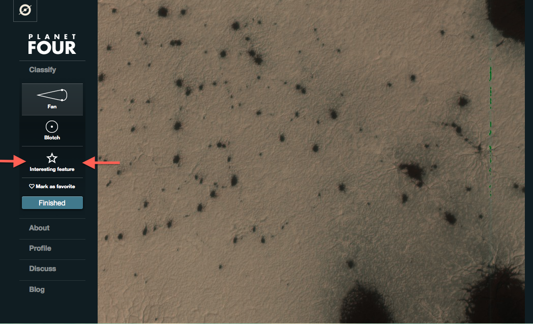
The Interesting Feature drawing tool can be found below the Blotch drawing tool in the classification interface. (see the red arrows below in the screen shot).
You may have also spotted bright roundish small blobs in the images where there are dark fans or dark blotches. Like these:
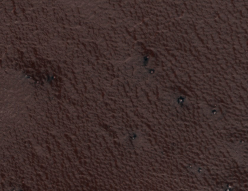
These are bright roundish features are boulders and we think in on region on the South Pole they may have some role in the formation of fans. If see an image like above or below:
Please also mark these with an Interesting Feature Tool after marking blotches and fans in the images and highlight the boulders on Planet Four Talk with #boulder
More on Planet Four
Greetings Earthings,
Hi, I’m Meg Schwamb a postdoctoral fellow at Yale University and member of the Planet Four Team. The response from BBC Stargazing viewers has been amazing and we want to thank all of you for participating in the project. Thanks for helping us explore the surface of Mars and study the seasonal processes ongoing on the fourth planet from the Sun.
The images we’re asking you to classify come from HiRISE (High Resolution Imaging NASA’s camera on NASA’s Mars Reconnaissance Orbiter (MRO). MRO has been orbiting Mars since late 2006. HiRISE is a high resolution camera that is capable of seeing features the size of a dining room table on the surface of the Red Planet. This camera has been giving us the most detailed images of Mars that we can use to study how the surface changes with differing seasons and explore the geology of Mars from orbit. In addition MRO has helped keep rovers like NASA’s Curiosity ad Opportunity safe, with the capability to identify large rocks at potential landing sites that could damage a rover during landing.You might already be familiar with HiRISE images. MRO and HiRISE caught Curiosity on August 5, 2012 in the act as it was parachuting down to the surface to it’s future home at Gale Crater.
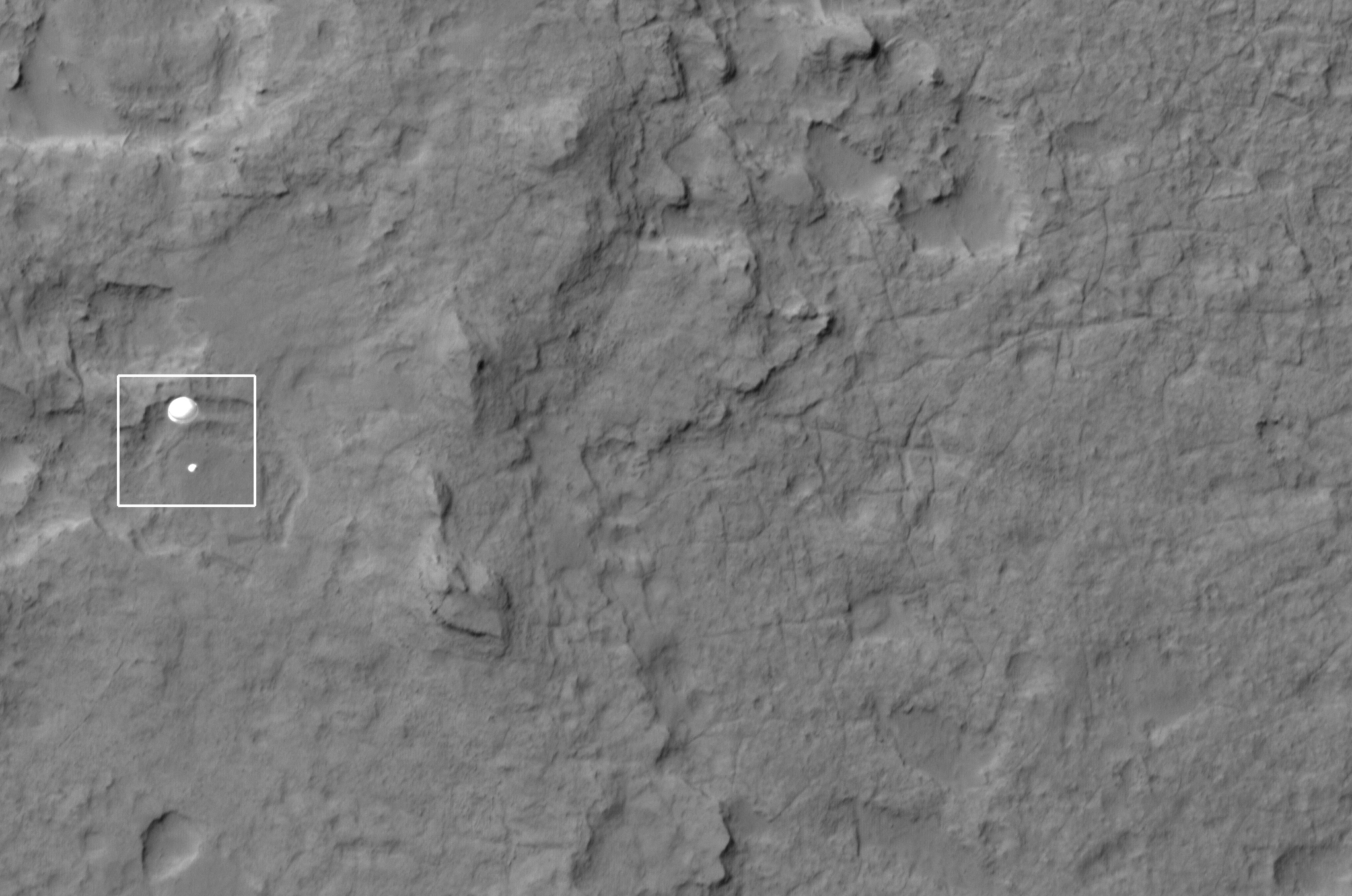
NASA’s Curiosity parachuting to the surface of Mars imaged by HiISE and MRO Image Credit: NASA/JPL/Univ. of Arizona
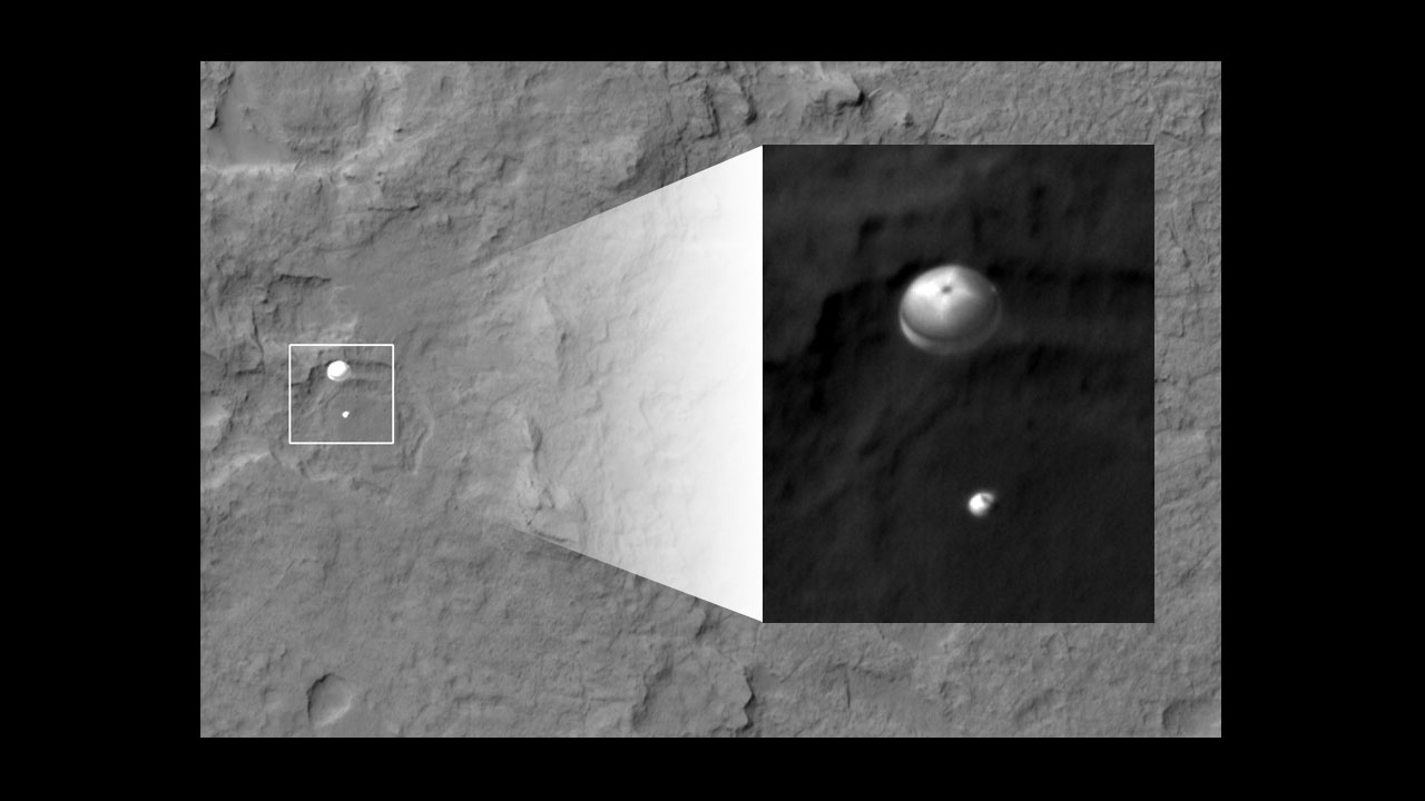
Zoom in of Curiosity descent Image Credit: NASA/JPL/Univ. of Arizona
On Planet Four, you’re seeing images of the South Pole of Mars. We are asking you to mark these beautiful dark fans and dark blotches that appear and disappear during the Spring and Summer on the South Pole of Mars. During the winter carbon dioxide (CO2) condenses from the atmosphere onto the ground and forms the seasonal ice sheet. The ice begins to sublimate in the spring, and the seasonal cap retreats. There we see over the Martian spring and summer these dark fans and blotches. They begin to appear in the Southern spring when the ice cap begins to thaw and sublimate back into the atmosphere. The fans and blotches then disappear at the end of the summer when there is no more ice left.
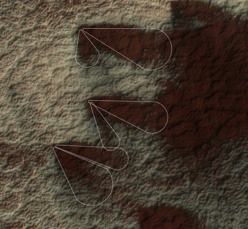
Seasonal fans marked in the Planet Four interface
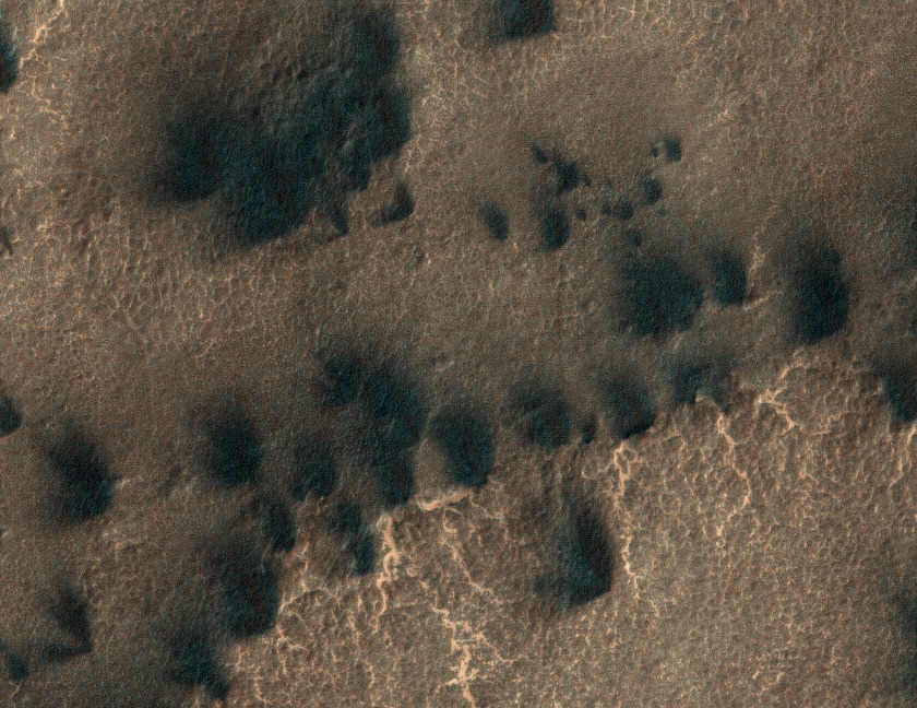
More fans and blotches
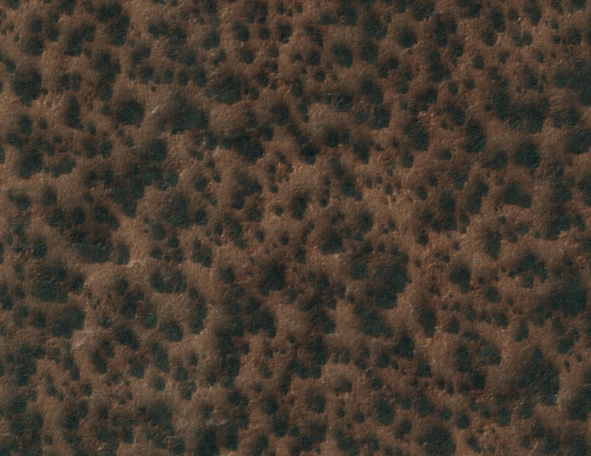
More fans and blotches
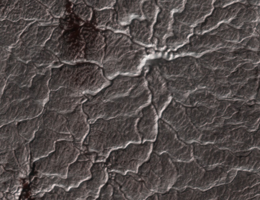
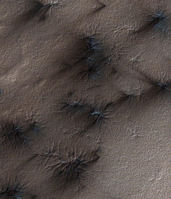
Later in the spring/summer season as the ice thins that we see these channels have been carved in the surface. Many originate from a single point and radiate outward. Others just like a patches of swiggly lines crisscrossing or in orderly rows. Those ridges are channels in the soil that are sculpted by carbon dioxide gas. These veins in the images are what we call “spiders” or araneiform terrain.
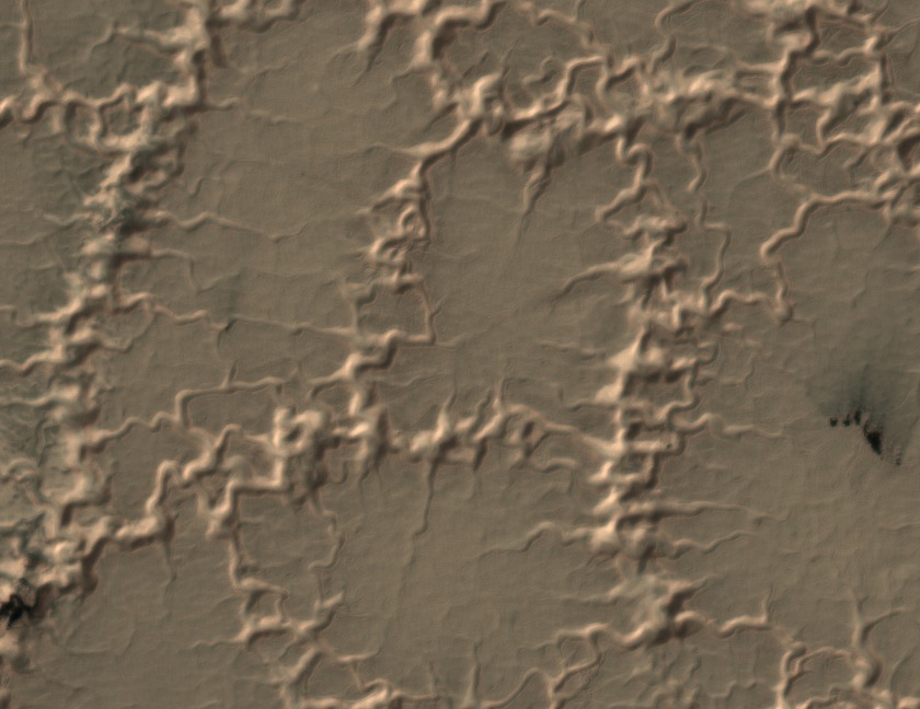
spiders-like or araneiform terrain with channels carved by carbon dioxide gas
spiders-like or araneiform terrain with channels carved by carbon dioxide gas
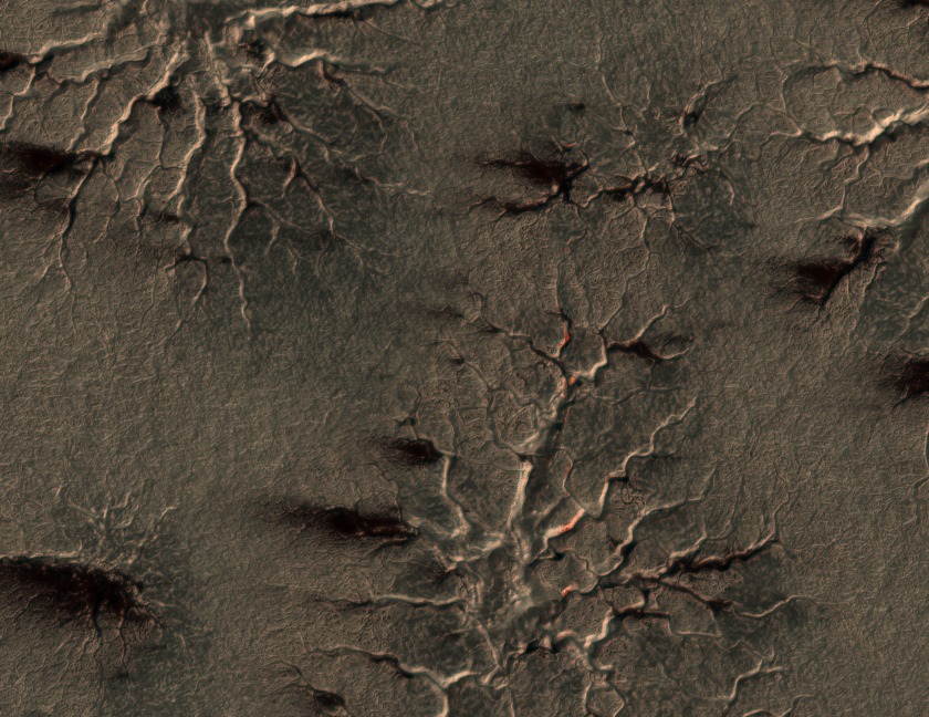
spiders-like or araneiform terrain with channels carved by carbon dioxide gas
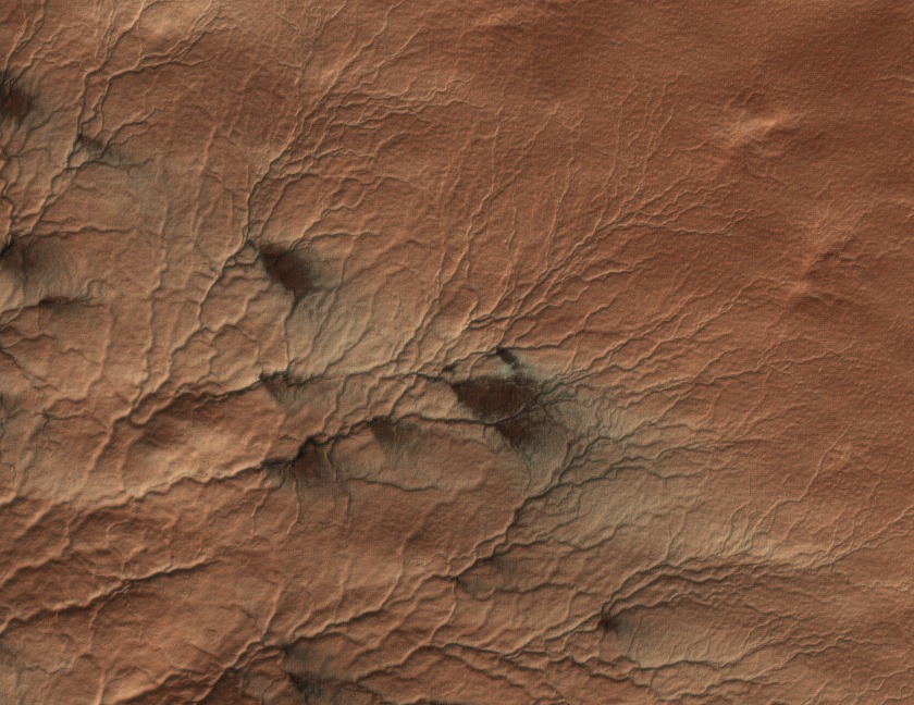
spiders-like or araneiform terrain with channels carved by carbon dioxide gas. Here you can see there are some fans that appear to be originating from geysers that develop in these channels
Here’s how we think they form: In the spring/ summer when the sun come up the sun heats the base of the ice sheet the ice sublimates on the bottom creating carbon dioxide gas that carves these channels or spider-like features. The trapped carbon dioxide gas is rushing around the bottom carving these channels and tries to exploit any weaknesses in the ice sheet. If it can the gas propagates through cracks in the ice sheet the gas escaping into the atmosphere in geysers. The gas bringing along dust and dirt to the surface that we think get blown by surface winds into the beautiful fans we ask to mark or if no wind the blotches we ask you to map. This morphological phenomenon is unlike anything seen on Earth. You can learn more about all of this process we think is happening on the surface in our previous blog post.
We want to study how these fans form, how they repeat from Spring to Spring and also what they tell us about the surface winds on the South Polar cap. We only have very few limited wind measurements from spacecraft we’ve landed on Mars. If the fans are places where the wind is blowing, then they tell us the direction and the strength of the wind. Blotches then tell us where there is no wind.Your mapping of the fans and blotches would help provide largest surface wind map of Mars.
Over 10,000 participants worldwide have helped classify 340,052 MRO images. But we still need your help. There are many more images still waiting to be mapped. Help us out at http://www.planetfour.org/ today.
Mars Fan Club
Ever fancied taking a trip to the planet Mars? On Planet Four (http://www.planetfour.org) we’re asking everyone to help us find ‘fans’ on the Martian surface. Your classifications on this site will enable researchers to better understand the climate and surface of Mars. The images you see here are taken using a high-resolution camera in orbit around the Red Planet. We collect together everybody’s markings of objects on these images and average the result. This is a task that computers are not reliable at, but which humans are really good at. By crowdsourcing your efforts, we can produce data that will show us what is happening in these images.
HiRISE image is ~1 km across. Spiders and fans are visible.
Every winter Mars’ polar region is blanketed by a layer of frozen carbon dioxide (dry ice). In the Martian spring, this temporary polar cap warms back up and rapidly changes directly from ice to gas (a process called sublimation). This produces geyser-like eruptions through weak spots in the polar cap. Dust is trapped in these eruptions and is carried away by the wind where it then falls in a fan shape across the surface nearby – you can see these fans in the images on this page.
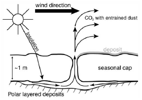
Model – figure from Piqueux et al., 2003
Over the winter the seasonal ice layer is transformed to translucent slab ice, which allows sunlight to penetrate to the ground below in the spring. The ground warms up causing the ice to sublimate from the bottom. This results in gas becoming trapped below the ice layer, under increasing pressure. When a crack or a rupture develops the gas flows out the opening. The escaping gas carries along loose material eroded from the ground. The gas and fine material flow up to the top of the ice layer and out into the ambient wind, as shown in the diagram above. The material lands on top of the seasonal ice layer, downwind of the vent, in fan-shaped deposits. After the seasonal ice layer is gone the fans blend back into the surface material and are no longer visible.
This same activity occurs every spring, and slowly erodes channels in the ground. Often the channels are radially organized, thus earning the colloquial name “spiders”, and more formally “araneiform.” Channels are wide and shallow, generally less than 2 meters deep. In the winter the spiders are visible because the ice is draped over them; in the summer when the terrain is ice-free we see that the spiders are indeed channels carved into the surface, shown in the time-lapse sequence below.

Timelapse sequence of a spider initially covered with ~1m of ice (upper left), to ice-free (lower right).
The fans are markers for the wind direction and speed at the time that the gas was escaping and carrying its load of entrained material. Sometimes the vents close and re-open and sometimes the wind changes direction, with the result that we see multiple fans from a single source region. This is all raw data that can be compared to predictions of models for Mars’ atmospheric dynamics, known as global circulation models (GCMs). Sometimes when the conditions are just right the gas will condense into fresh frost particles and form bright fans.
We hope to share more about the background to this project via this blog. Meanwhile, why not go and find some fans? Visit http://www.planetfour.org to start classifying.
Welcome to Planet Four
…well not literally. You’re still on Earth – don’t worry.
